Up until 3.17 there were little to no observable liquid states on Microtech. Only vast amounts of ice and some atmospheric vapour.
Cornerstone has always been at the forefront of scientific analysis and we needed no excuse to explore this subject matter in greater detail. We have outlined our goals and have tried to take the data at face value, meaning all theories presented do not take future development into account but only what we can be seen in game at present.
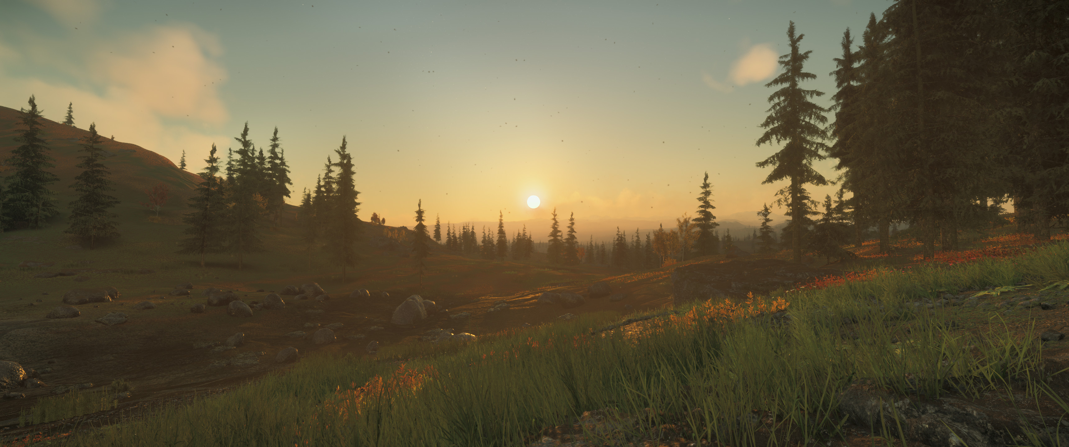
PROJECT GOALS
- To collect data on the temperate biome of Microtech, specifically in close proximity to the river and basin.
- To compare the geographical and climate data along the river between 3.16 to 3.17 and report any discoveries or trends.
- To provide reasonable theories based on the data captured and analysed during the survey.
PREPERATION
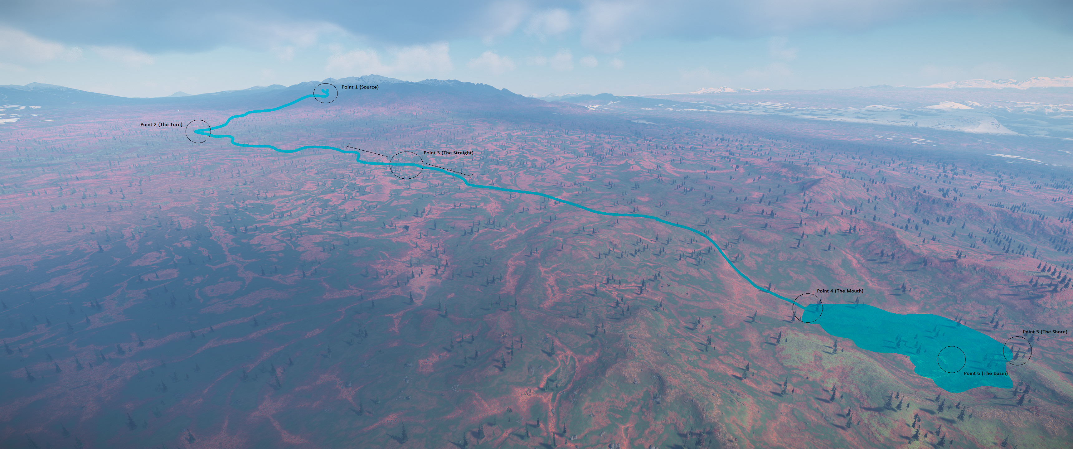
Firstly as our goals suggested, we needed to map the river location into 3.16 so that our analysts could begin collecting data of the area that was in close proximity to the river (the future river). Luckily due to some eagle eyed viewers we had the rough coordinates to work with. From there we received further concrete data of the coordinates from the rivers source, all the way to the basin. By image matching and tracing we could roughly map the river into 3.16, ready for exploration
Data Survey
To efficiently map out the survey as a team, we decided to identify 6 key landmarks of the river and focussed our efforts around these areas.
Source, Turn, Straight, Mouth, Shore, Basin
Once identified we could then begin mapping data such as "Surface Elevation", "Temperature" etc
Flora and Fauna Survey
Another purpose of this survey was to identify all organic and biological data within the temperate biome, as well as those close to the river itself, with the secondary goal of hopefully identifying new species in 3.17, once the river was included.
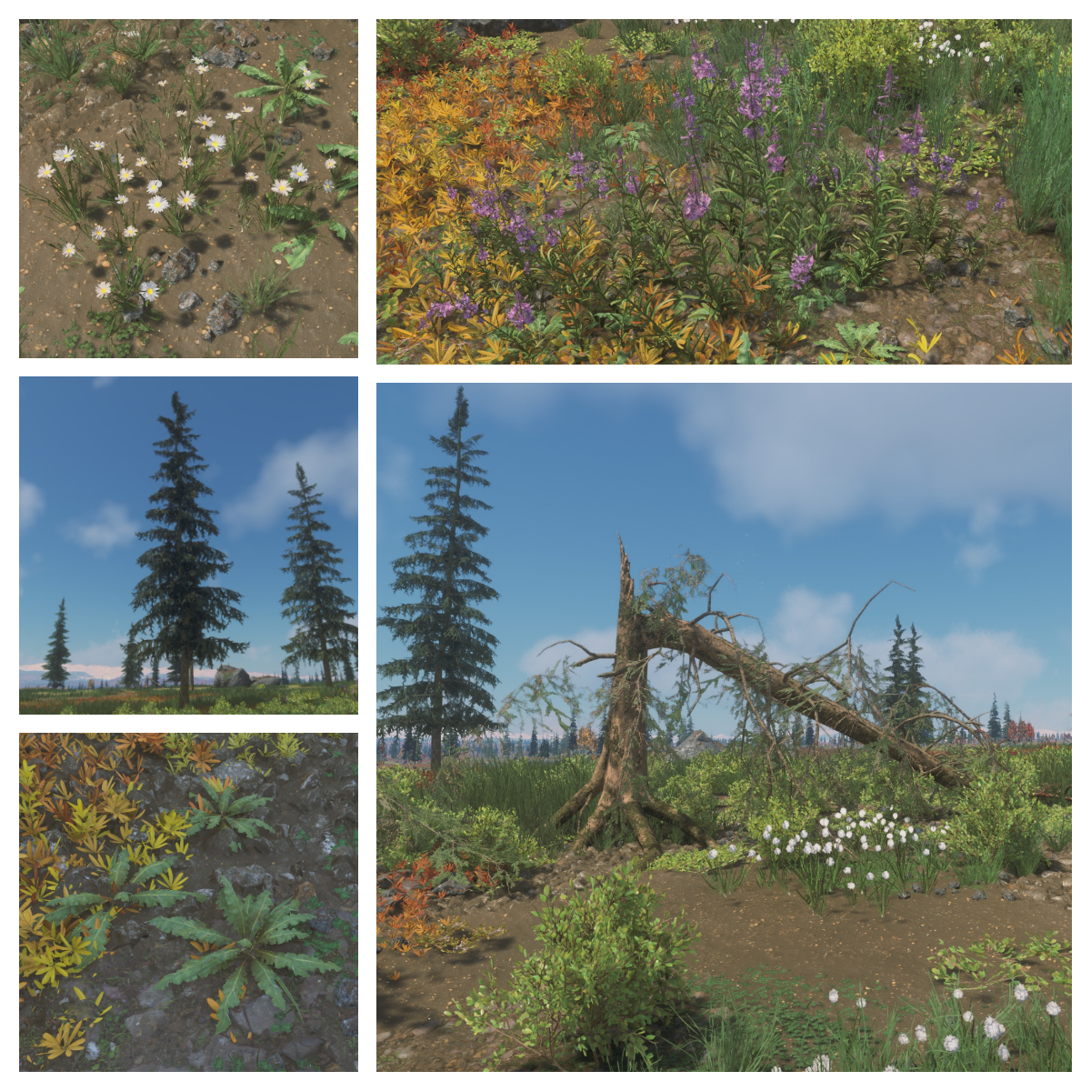
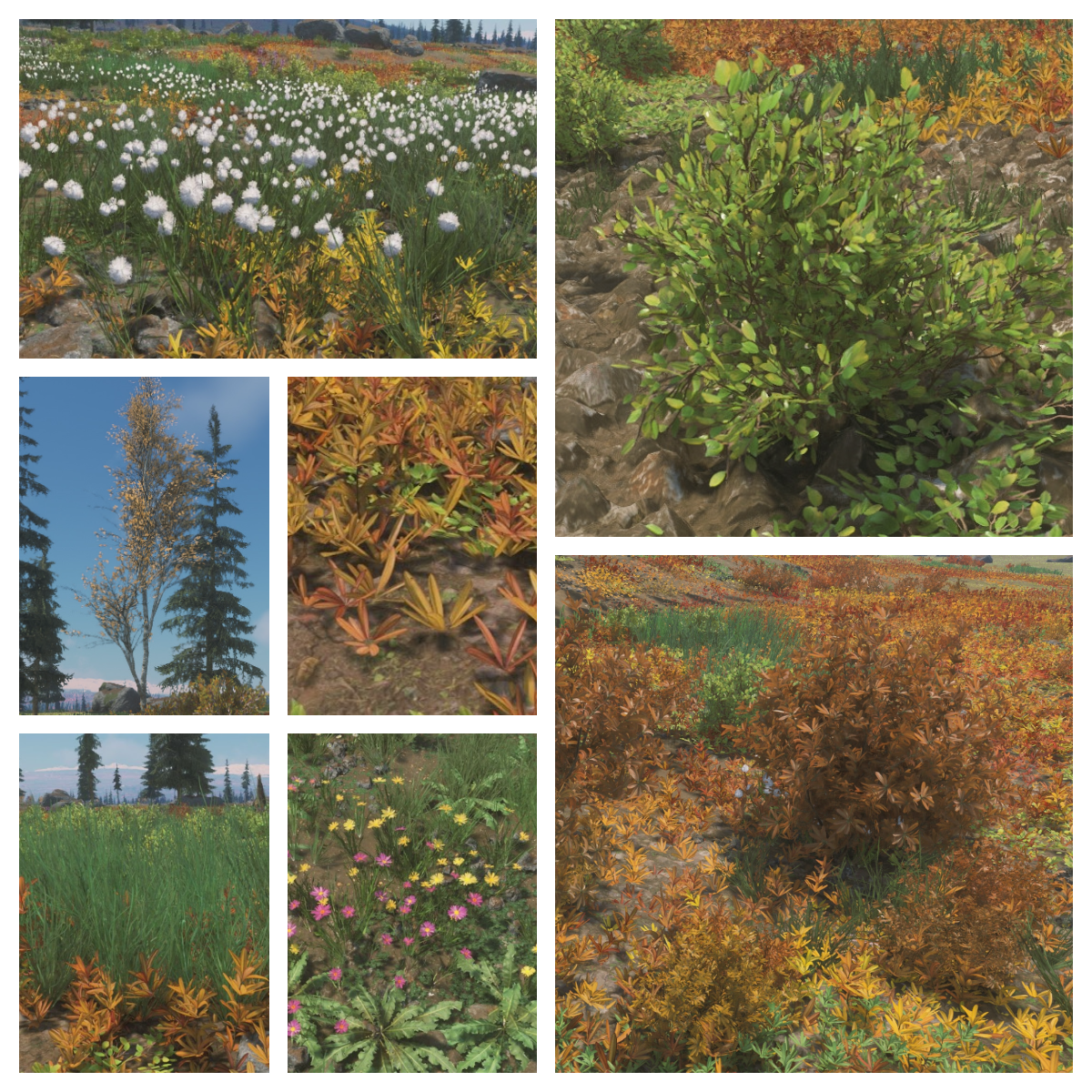
We identified 12 major flora assets within this biome and documented them below. No Fauna has been identified yet.
Photogrammetry Experimentation
We have begun to build out our future pipelines to include photogrammetry and point cloud data so that we may, in time, be able to scan the assets for further analysis outside of normal planet constraints and take our data with us.
In this example you can see the in game shot on the left, and the point cloud and mesh data on the right. In the future we hope to have these uploaded to our site, ready for live manipulation and viewing by yourselves so that you too can analyse our data. The technology is still somewhat in its infancy though.
RESULTS
It is important to note that whilst we have taken every precaution to ensure our data is accurate and maintains continuity, we do allow for an element of flexibility. Weather and time of day are large underlying factors when taking data such as this so please bear this in mind when reviewing all the data.
Temperature, Foliage Density and Surface Height
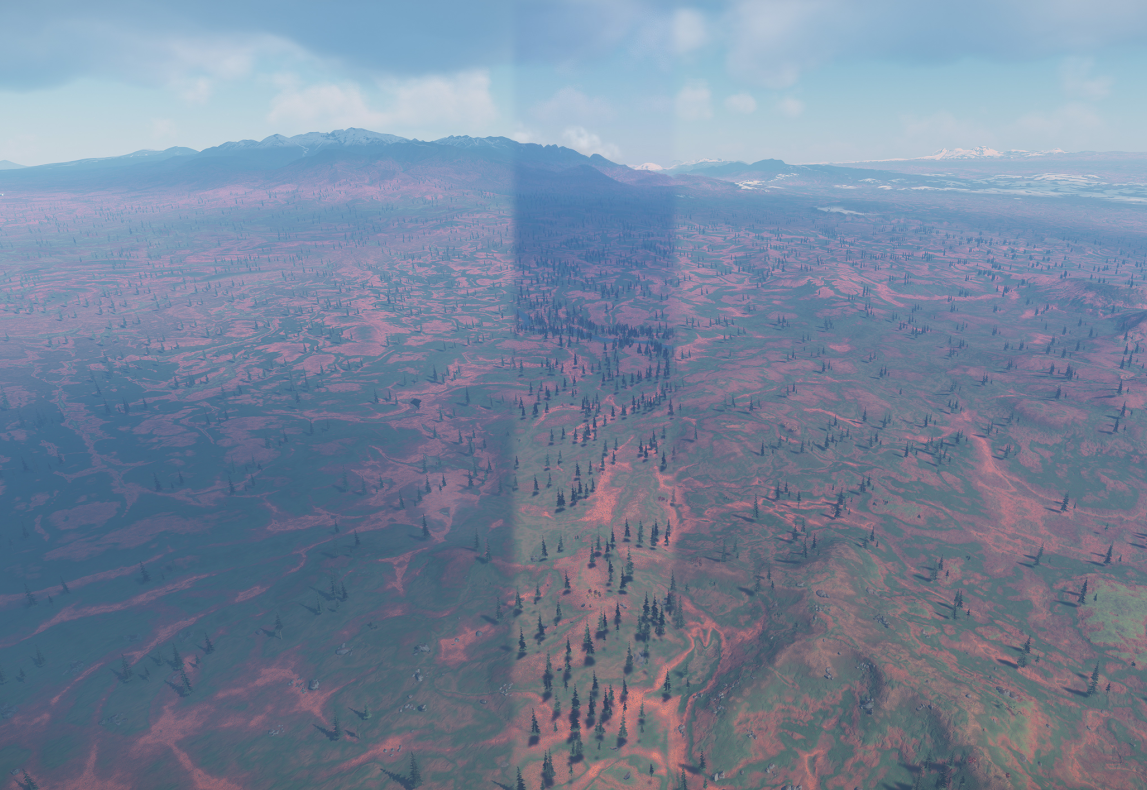
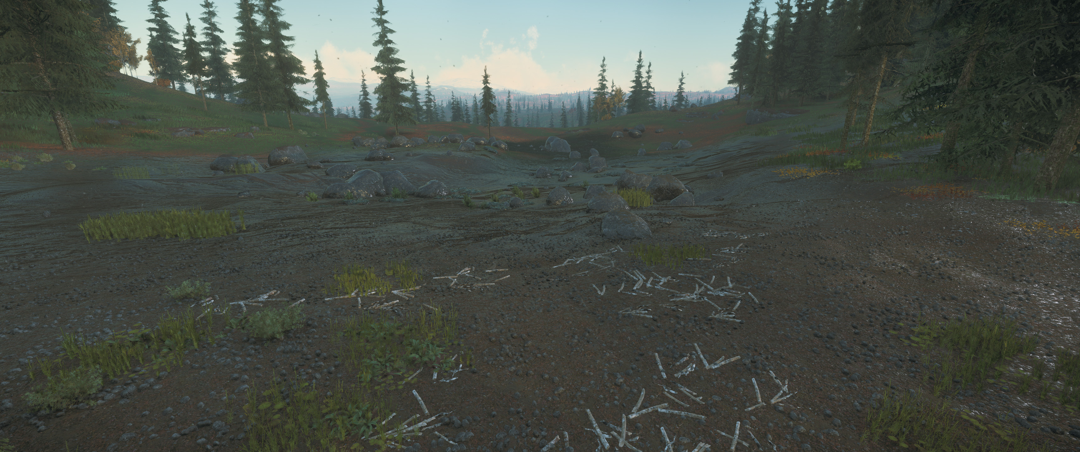
Tree and foliage density has increased dramatically around the river location in 3.17, compared to that of 3.16. An example of this can be seen below.
This image shows a strip of tree density from 3.17 laid over an image taken in 3.16 and below, Meepowski worked tirelessly on stitching these images of 3.16 vs 3.17 together. You can clearly see terrain differences.
Click to open in a new tab Click to open in a new tab Click to open in a new tab
In regards to temperature, we detected a 5 - 10 degree INCREASE in overall outside temperatures in proximity to the river. These readings were taken at midday and in clear weather.
We believe the character suits temperature sensors are actually reporting on wind chill factor and not direct ambient temperature. With this in mind, and with greater tree density to break up the surface winds, we would expect to see drastic changes in our suits temperature readings from 3.16 to 3.17.
The source of the river is recorded at being at a rough elevation of 1061 ± 10m with a recorded temperature of −13 °C
The mouth of the river is recorded at being at a rough elevation of 348 ± 10m with a recorded temperature of 0 °C
These temperatures will change drastically based off time of day and weather.
Flora and Fauna Assets
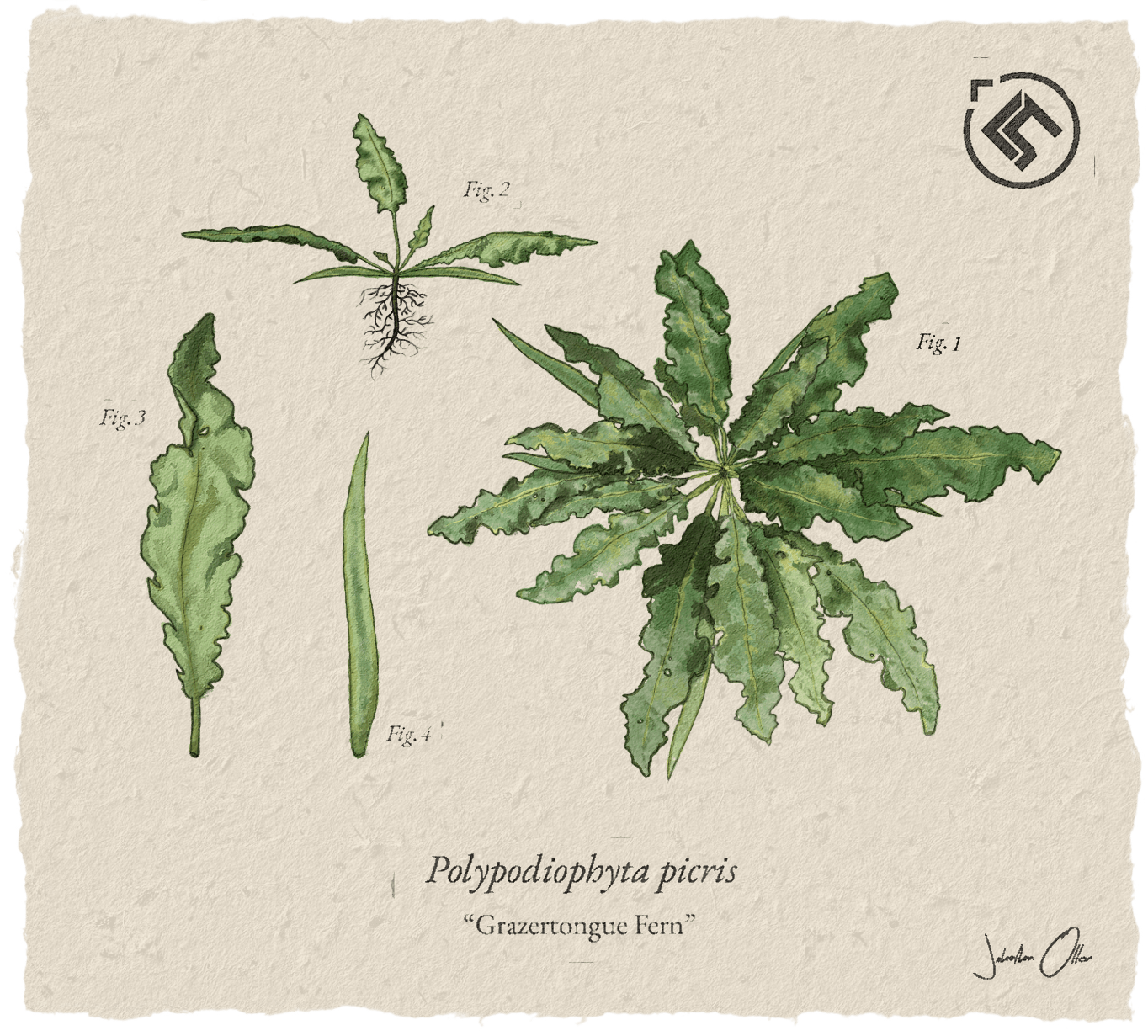
We discovered 4 new assets in and around the river. We have logged them below.
DISCOVERY THEORY
We believe that from analysing the data taken during the survey, especially in proximity to the river, that Microtech is heating up.
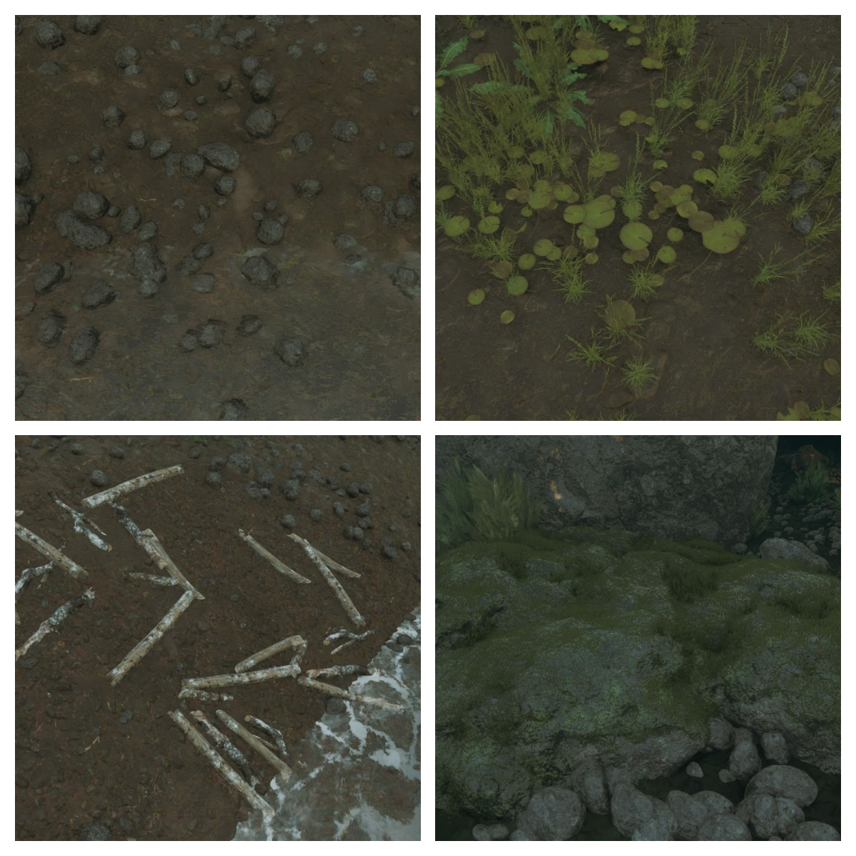
Please refer to the first image above of the cluster of small stones/rocks. These are intentionally smooth in nature and can only be found in and around the river. In some cases up to 40m away from the river itself. These stones would take 100s of years to smooth through natural river erosion as we see here on Earth. If this is to be believed, then the river is shrinking, most likely due to changes in atmospheric temperature and in some cases, the river has halved in width.
Further evidence presented below is a shot of the back of the basin where you can clearly see where another pool of water used to be located. Assets in this small region match those within the base of the lake and drift wood deposits can clearly be seen up close which would outline the original body of water. If we are to theorize further, we could say that the water levels have decreased and this small lake has dried up.
GEOLOGICAL ANALYSIS
After closer inspection we believe that most of the rocks on Microtech are Igneous, most of them resemble Basalt. Igneous rocks are formed through volcanic activity when the magma cools and crystallizes. So was there previous volcanic activity on Microtech? Most definitely. Are they dormant? The data would suggest so.
Further evidence of volcanic activity can be seen at the poles of Microtech. Huge biomes of Obsidian can be noted in these important locations that would signify that a substantial amount of volcanic activity presided over these regions, centuries ago, leading to huge spikes in CO2.
CO2 EFFECTS
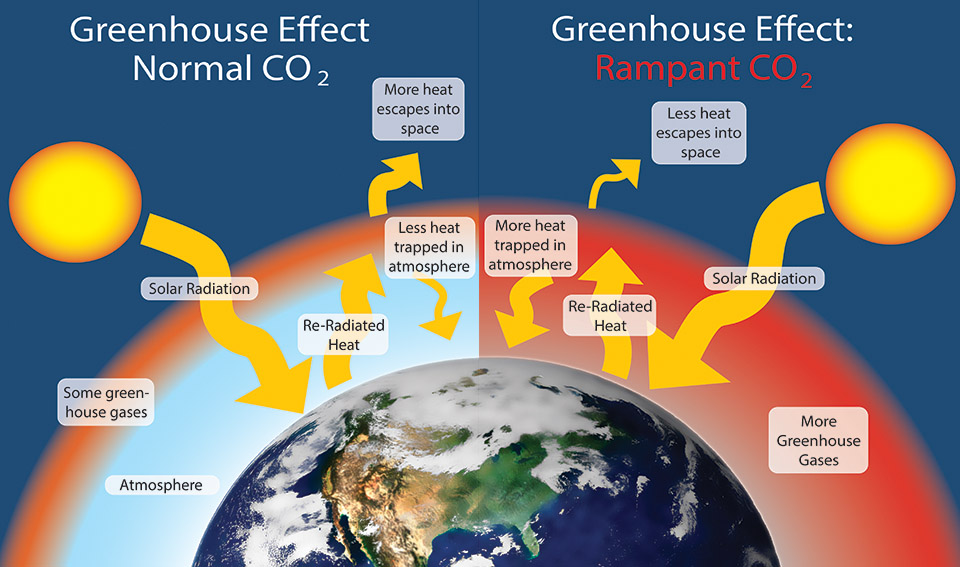
The diagram below explains the effects CO2 has on a planets atmosphere.
Volcanic activity at the poles would have had a dramatic effect on CO2 levels in the atmosphere. At present CO2 levels on the planet are within breathable limits (0.04%), most likely due to the terraforming performed 100 years ago.
CO2 levels would've been, no doubt, toxic to humans and temperatures would be too high to sustain human life. Was this the original reason for the terraforming in the first place? We are still yet to confirm, but with the data we have it makes logical sense
One thing we do know is that it wouldve taken 100s of years to smooth these rocks, meaning these rivers were here before the terraforming of Microtech. We know from previous studies on Earth that increased CO2 levels can lead to heavier precipitation, and this rainfall couldve sustained rivers such as these before the accident.
We ran further expeditions to the ice lakes to see if we could see any further evidence of these assets being displayed but none were visible, meaning that these lakes have most likely been frozen for some time and the snow density has covered what little evidence is present.
IN CLOSING
It is interesting how small rocks can lead to such larger conversations and theories around the past, present and future of a planet. Star Citizen has always been a fascinating subject matter. Not just a game to many but also a place of study.
We are aware there could be multiple theories and reasons for the smooth river stones and their placement. Our evidence is somewhat circumstantial and depends on observations in a game environment still in development but based on current knowledgebases on Star Citizen, what we can observe in-game, and current climate understanding we feel confident in presenting these theories to the public. We like to look at what is presented to us now, and put the development cycle to the back of our minds and just focus on the data we have in front of us. Immerse in the ‘verse!
We hope that you have enjoyed reading this scientific survey and the theoretical conclusions presented herein. We welcome any conversations and further discussions. We are by no means experts and always make our studies public so that they may be reviewed and built upon by others.
CREDITS
Smut - Cowl - Meepowski - Elytrak7 - Zachbev08 - FXZMatt - Delori - 2Echo - OTT_R - Blue - CaptSheppard - ZirroSatva - Quantum Kitty - JustMurphy (for his sunset calculation tool)
WHATS NEXT (sneak peak)
Hand drawn by OTT_R

